
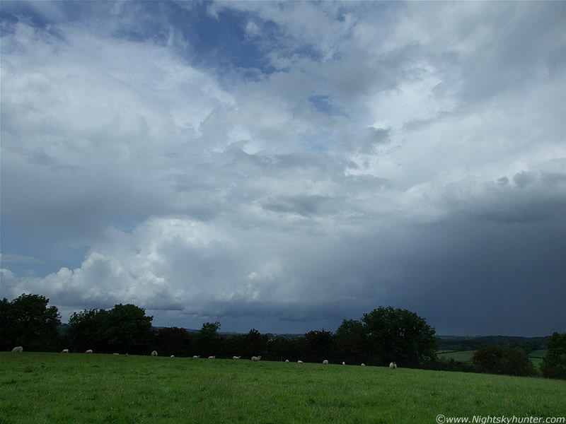
This is the second image account covering a three day period of storm action over N. Ireland, and one of two accounts covering Sunday June 14th. This day produced three storms, two from Maghera followed by a stunner later in the evening over Ballyronan, so this account covers the first two local storms which were afternoon events. My memory is a little fuzzy since I have put off doing these accounts for so long now so I can't recall the exact synoptic set-up for these storms, I think the CAPE was 1100 or 1200 with an LI between -2 and -3 with strong solar heating and slack SWly flow. Again, N. Ireland was one of the main places to be in the UK with thunderstorms expected to break out all day. By mid morning the convection was stunning, and to repeat what I said in the previous account, it was among the finest I have ever seen, and on par with the stunning examples seen in other countries. Updraught towers and cu fields fired up from the word go as powerful looking solid structures showing some wind shear so things were looking fantastic. CBs and Showers were erupting so fast that the local radar couldn't keep up them thanks to the +30 min delay between updates. I spent a little time in the hot midday Sun in the Maghera countryside studying the convection when a cell with large anvil and solid gust front swept over me and dumped a 5 min torrential shower on me. Once it passed overhead I could see the updraught region and was impressed to see the entire area rotating in a very obvious manner with a large swirling mass of cloud which was really nice. Things were looking good, and the most unstable period of the day was hours away yet. Back at home, the radar showed storms all over the place, some to my SW, another to the N, others on the NE coast and a cluster further S, some of these were in visual range so I headed out to a good spot with the camera.
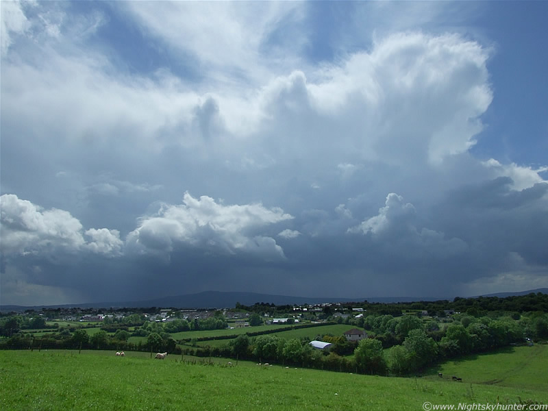
The convection was amazing, huge mountains of exploding updraughts passing behind trees and over roads with bases so low that they seemed to scrap the ground at times, the sky looked like it was ready to explode at any moment. To my SW, miles away on the horizon, I seen a monster cell on the SW side of Slieve Gallion, it had a well defined base with strands of precip falling from below and on top could be seen two anvils, side by side, these two cells had merged together into one entity. The anvils were mind blowing, not the rubbish wispy/soft kind which indicate weak updraughts, these were serious - the real deal. Both extended up to an incredible vertical height and looked so solid that they reminded me of two concrete slaps suspended vertically in the atmosphere. There was serious air moving around in that thing, and it was heading slowly to the NE, straight for me. I changed location to an old favourite spot which provided me with a good view of these twin cells, which I knew were storms. I did get images of those solid anvils but due to the distance and hazy sunshine they didn't turn out very good. I was concentrating so much on this one that I forget to look behind me, when I did, I seen another storm to my N.
 |
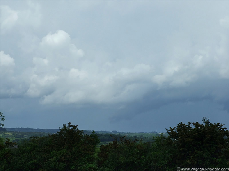
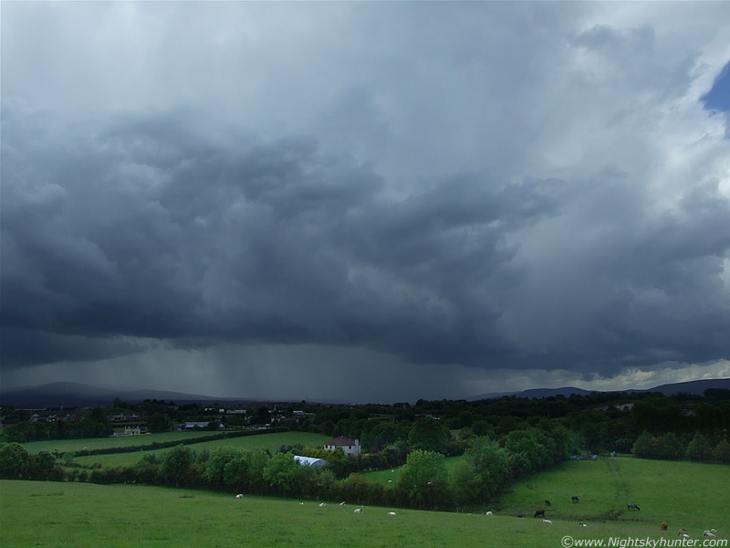
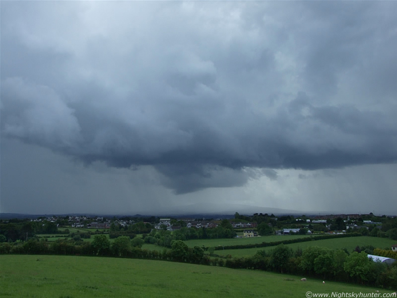
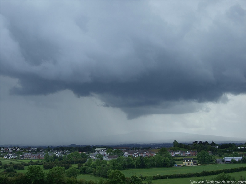
I'm now between two storms at the same time. This is the N storm, it's moving from L to R and it looked very impressive, well it did until mid level cloud tried to hide the anvil etc which was when this image was taken. To the R is the dark outflow region where precip was falling, blue c-gs and I-cs were flashing in there periodically with distant rumbles of thunder. To the L was a very long flanking line of updraught towers, you can just make out one of those towers to the LOC behind the mid level cloud. To the upper R you can see part of the anvil through the same cloud. The rain free base (RFB) looked like a potential funnel spawning ground. I turned back to the first storm which was still miles away, then back again to storm two...
 |
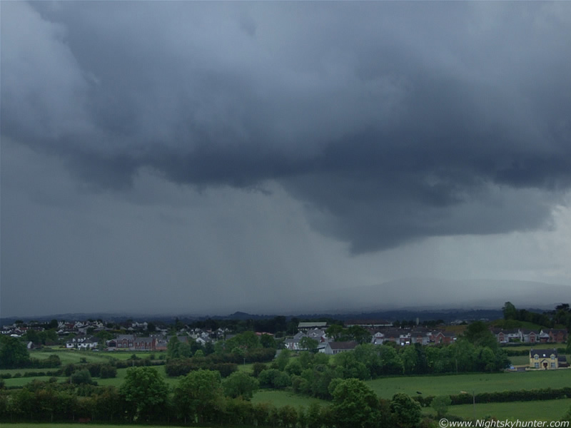
...which was when I spotted this, which must have suddenly dropped from the RFB when my back was turned. At a first glance I thought it was some kind of inflow scud, but a closer look shows a well defined solid looking structure going well up into, and connecting with, the RFB.
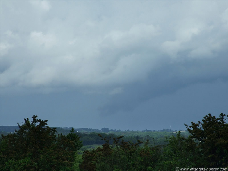 |
Could it be?, it was too far to see obvious rotation, all these images were taken with the zoom lens in uncomfortable conditions. That's extremely low to the ground, just above the height of that wind turbine to the R.
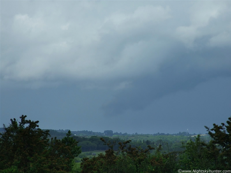 |
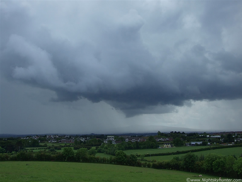
There's a chance this could have been a funnel, or some sort of wall cloud, guess I will never know.
 |
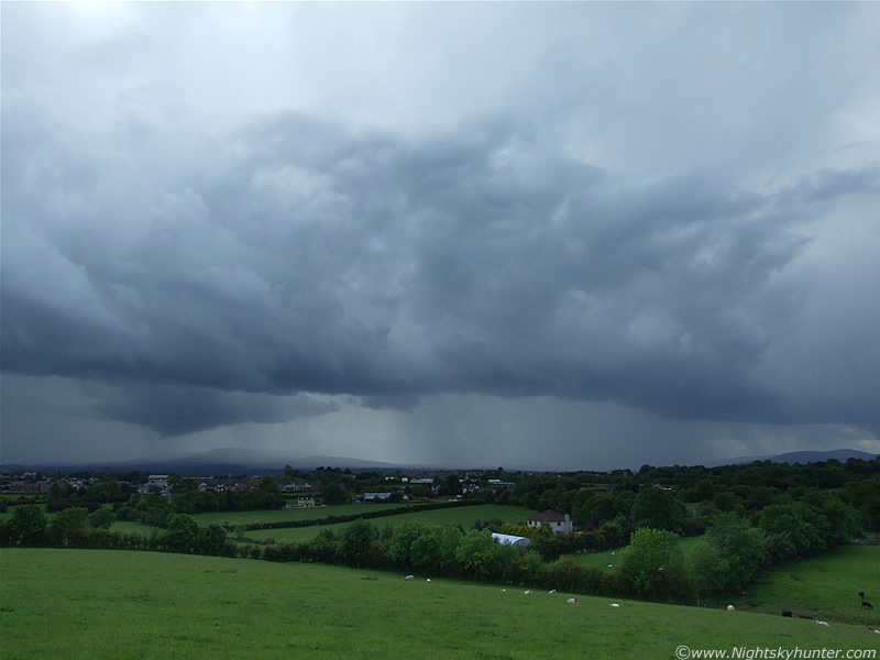
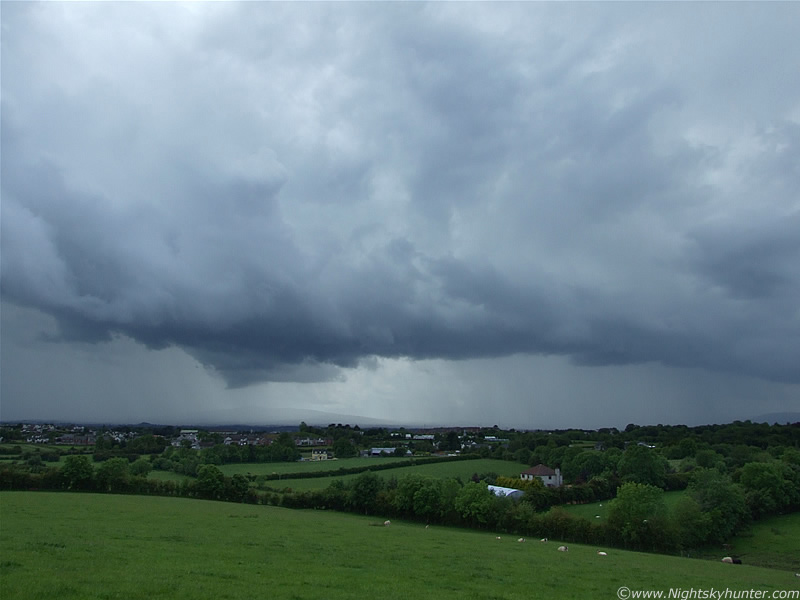
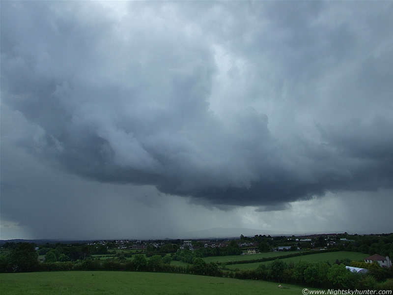
Turning around and looking back to the SW at storm 1. This looked beautiful as it approached me with anvils and forming gust front/shelf cloud and precip rapidly breaking out from the base. The R anvil became wispy and obscured the solid anvil in the L, however it kept rejuvenating itself on regular intervals. This is looking directly towards Maghera.
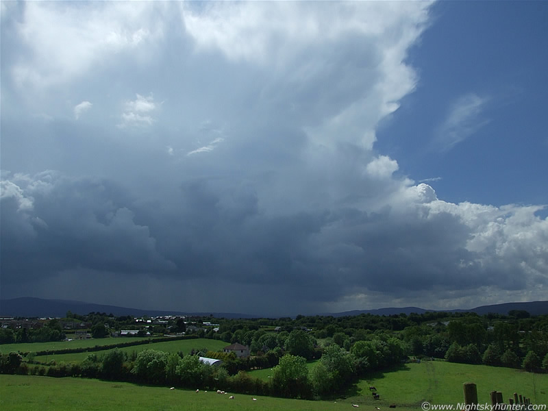 |
The first of many angry rumbles of thunder could be heard, and that's still a serious distance away, even more than it seems in the image. The thunder became louder as the storm closed the gap and my adrenaline began to race through my body, I love it when I'm in the moment like this with mother nature showing off while at the same time getting a confusing mix of emotions like excitement and fear at the same time. I hadn't see the lightning yet so I didn't know what kind it was. The heat and intense sunshine at this point were really getting to me. Sweat was dripping down my face like a waterfall and getting into my eyes causing them to sting and blur. I had to strip down to a t-shirt to stay cool.
 |
Now the storm was getting MUCH closer, close enough to not only hear, but it would seem, also 'feel' the thunder. I was taking images and video non stop now, I was amazed my batteries held out for so long, I had back-ups anyway. Beforehand I was having trouble getting the camera focused and the correct exposure due to the sunlight making things difficult to see through my LCD screen and viewfinder. However, with the storm advancing menacingly towards me I began to see things much better as the anvil began to fade the Sun. The structure on this storm was very cool looking with lovely white anvils (32,000ft high) with developing shelf cloud and very finely structured precip curtains falling across the country with rumbles. I was in heaven.
 |
Vertical shot showing more of the anvil and W side of the storm. The E side extends away out of frame to the L. It began to cool now so I put my jacket back on.
 |
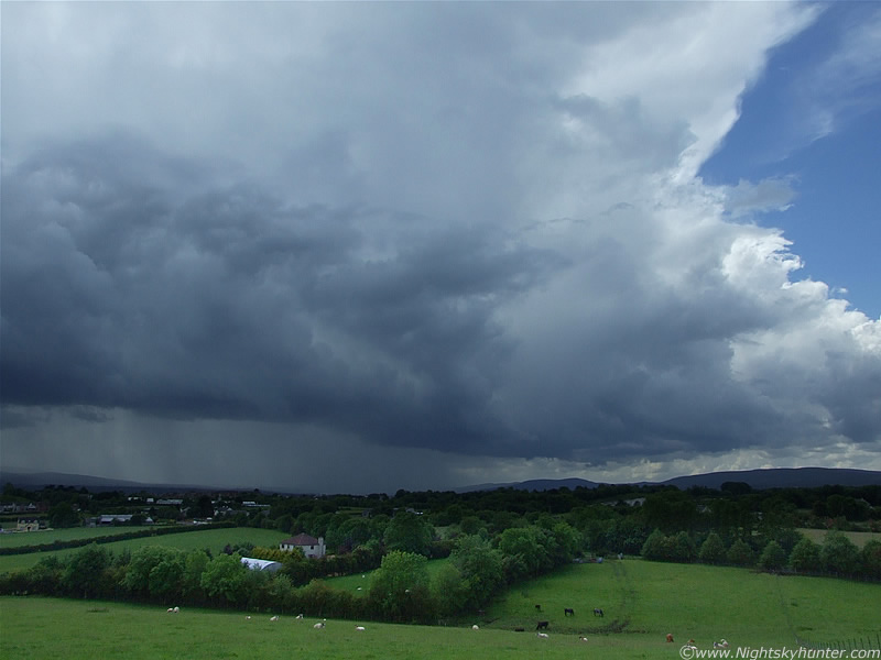
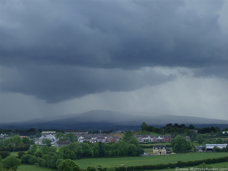
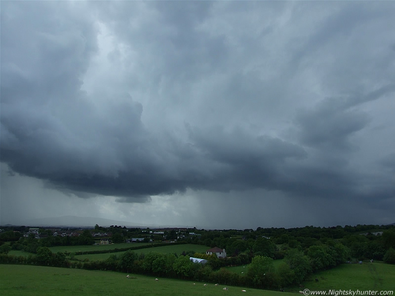
The dark shelf and base of the storm looked great contrasting with the peaceful green fields. That's Slieve Gallion getting a soaking to the far L with part of the Sperrin Mountains to the R. This is a great area to photograph local storms from, if you want to get dramatic shots with cool structures then you need to be at an elevated location to catch the storm in relation to it's landscape to get a sense of scale. I'm obsessed with having a good horizon, the base of the storm is the most important area so an unobstructed view is essential for increasing the chances of spotting a funnel or tornado. Also, you get a great view of the lightning, you can actually see what it hits.
 |
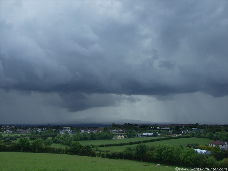
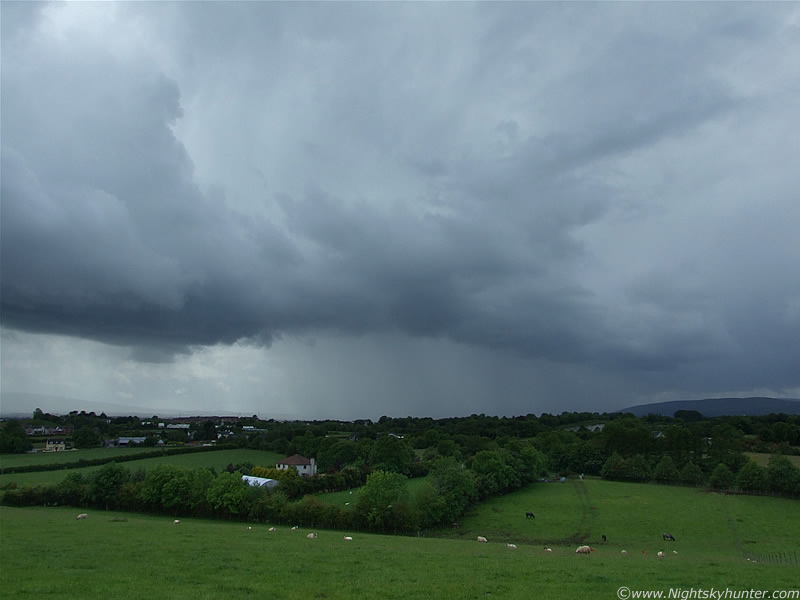
Zooming in on the storm region begin the shelf where the precip was falling over Slieve Gallion. Now I was seeing more lightning and hearing more thunder, not just from this storm, but rumbles from the other one behind me. That's a very well defined precip curtain working it's way down the mountain towards Maghera.
 |
Wider shot of same scene. Storm was too close now to get the entire thing in the frame of the camera. Lovely pure blue c-gs hitting down to the L and R from both cells. I actually had a great video clip showing one of those bolts hitting down fairly close to me, but I accidentally deleted later. The anvil on this storm were huge. It was blown down-wind by the SWly flow and passing above me through the zenith and away into the NE sky sector where it's outer rim could be seen at a phenomenal height. Running down the W (R) side of the anvil where fairly well defined mammatus. Also, from the RHS of the storm extended a long cu and cu congestus field which stretched into the NW where it had formed another spectacular serious of exploding updraughts. The whole sky was a beautiful and dynamic place at this time.
 |
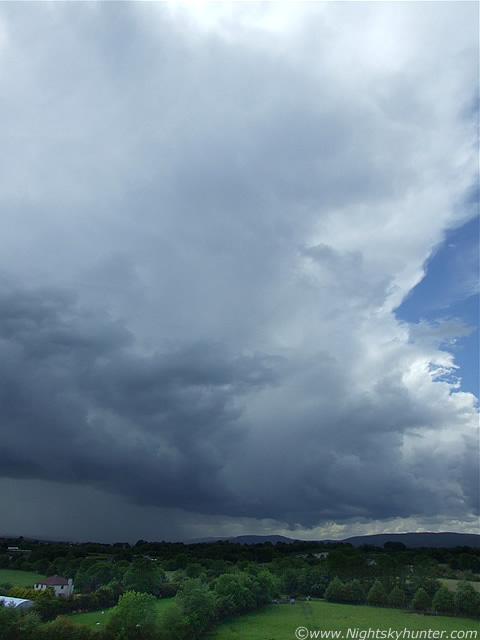
The clouds along the outflow boundary marking the shelf cloud actually became convective in themselves by developing strong towers which went up at high speed. Everything around me was as unstable as can be. That lowering under the storm really stood out!.
 |
I ignored the thunder and concentrated on it for a while. It had very well defined structure in there which looked very solid and healthy.
 |
Then a lowering formed under the main lowering.
 |
Back to wide angle. Many of the c-gs began to hit down to the RHS of the storm now. The shelf was forming very good structure. To be specific, it was two shelf clouds on both storm cells interacting and merging into one horizontal structure. You can see two areas of bowing/curvature to the L and R.
 |
I was really happy with this storm, it had lovely structure, was very photogenic, produced nice precip curtains, and produced enough c-gs and thunder to keep me entertained. The rumbles from this one drowned out the thunder from storm 2 which was now fairly distant, I could still see it but the anvil from this one was turning the sky overcast.
 |
I was crossing my fingers for a funnel or better, I would love to catch one dropping over the mountains. I think on this image you can really appreciate how large this storm is, just compare that huge lowering/updraught base (which is just a small part of the entire cell merger) and compare it with the houses below.
 |
The shelf really does look like a line of updraught towers now.
 |
Nice bend in the shelf as it gets very close to me. More c-gs hitting down to the R over the Sperrins and on the W side of the Coleraine Road, which is hidden by trees from this vantage point.
 |
I let the storm pass over me. It dropped torrential rain and more thunder/lightning. I headed home after this since the photogenic period had passed. The roads were flooded at the sides and quite a torrent of rain ran into the drains, the outflow was fairly strong.
Back at home I watched the storm move away into the NE with mammatus on the rear of the anvil and rumbling away as it did so. I was extremely satisfied. That's five thunderstorms and a funnel cloud (with several suspects aside) I have seen over the last two days, however the show was not over yet, the most spectacular action would later appear during the evening, and unknown to me at this time, it would be the structure sight of a life time. Thunderstorm number three of the day will be the subject of my next report. Thanks for reading.
Martin McKenna